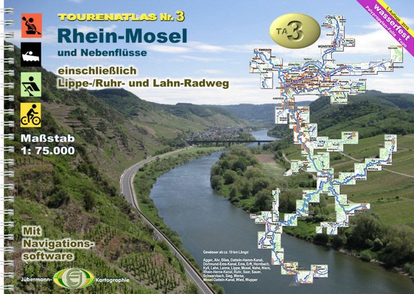
Canoe Map Guide TA3 Rhein-Mosel 2016
Product no.: 50066001
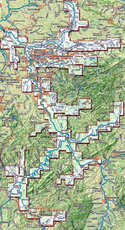
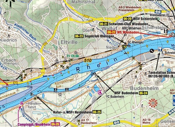
Description
River hiking maps for the Rhine-Moselle area: Atlas with detailed water sports maps in the proven 1:75,000 scale. Clear, handy and extremely meaningful. The Saar, Moselle, Rhine area from Mainz and almost all tributaries in this catchment area are covered. This atlas provides all the information that both water hikers and cyclists need on the go : km of water bodies, bans on landing and navigating, resting and bivouac areas, berths, slip, entry and exit options, Buoyage, bridge heights, addresses and equipment list of the clubs and campsites, and a map display, that doesn't stop behind the dyke, so it's also ideal for shore excursions. For cyclists, cycle routes on the following rivers are included in detail: Lippe, Ruhr, Lahn including alternative routes, bad routes, slopes, quarters, bakeries, grocery stores, restaurants, sights. The maps were completely drawn by Jübermann-Verlag. Thanks to aerial photo analysis and on-site mapping (from 2014 and 2015) by bike and boat, the up-to-dateness leaves nothing to be desired. Of course, there is also an update sheet for this atlas as a PDF document that can be downloaded free of charge. The navigation software JONA is included again (download the program, activation code in the atlas). In addition to the maps, you will find a lot of other quarterly information here, especially about cycling. ISBN: TA3 Publisher: Jübermann Verlag Shipping weight (in kg): 0.3 Edition: 1st edition 2016 Author(s): Erhard Jübermann Binding Type: Spiral Binding Format: DIN A4 Scales: 1:75,000 Material: Polypropylene waterproof Publisher: Jübermann Verlag Number of cards: 62 Number of pages: 86