Jübermann Canoe Map Germany WW1
Product no.: 50066003
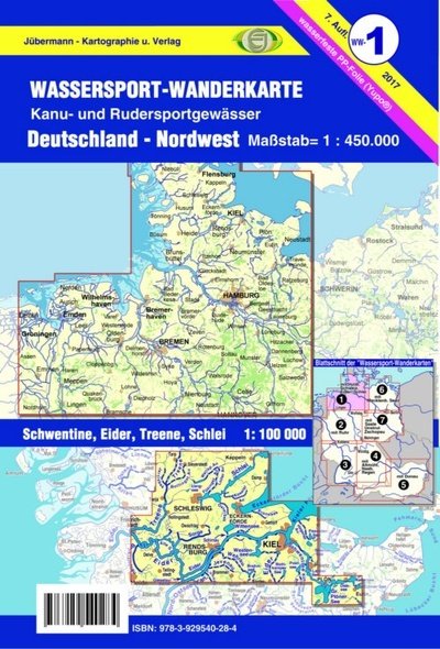
Description
The main map offers a planning overview of all waters that can be navigated by canoeists and rowers, including information on water levels, weirs / locks, campsites, canoeing and rowing clubs, water closures, river kilometers ..., The second side of the map depicts the waters in such detail that you will have no trouble finding your way along the way. The following bodies of water are included: Schwentine/Holsteinische Schweiz from Eutiner See, Kieler Förde, Hagener Au, Kührener Au, Eider (Bothkamper See to Friedrichstadt), Wehrau, Jevenau, Sorge, Treene, Schlei, Füsinger Au, Kiel Canal (km 25 to Kiel). Important fortifications or complicated passages are illustrated by additional map sketches, addresses of campsites, canoe u. rowing clubs and much more ISBN: 978-3-929540-28-4 Packing: in PE sleeve Publisher: Jübermann Verlag, Uelzen Edition: 7th edition 2017 Material: waterproof PP film (Yupo®) Format: DIN A1, folded to DIN A5 Scales: 1:450,000, Schwentine, Eider, Treen, Schlei on a scale of 1:100,000 Shipping weight (in kg): 0.05